Official tourism website for Northern Ireland
En

Burr Point

Ballyhalbert Harbour, Ballyhalbert, County Down, BT22 1DL
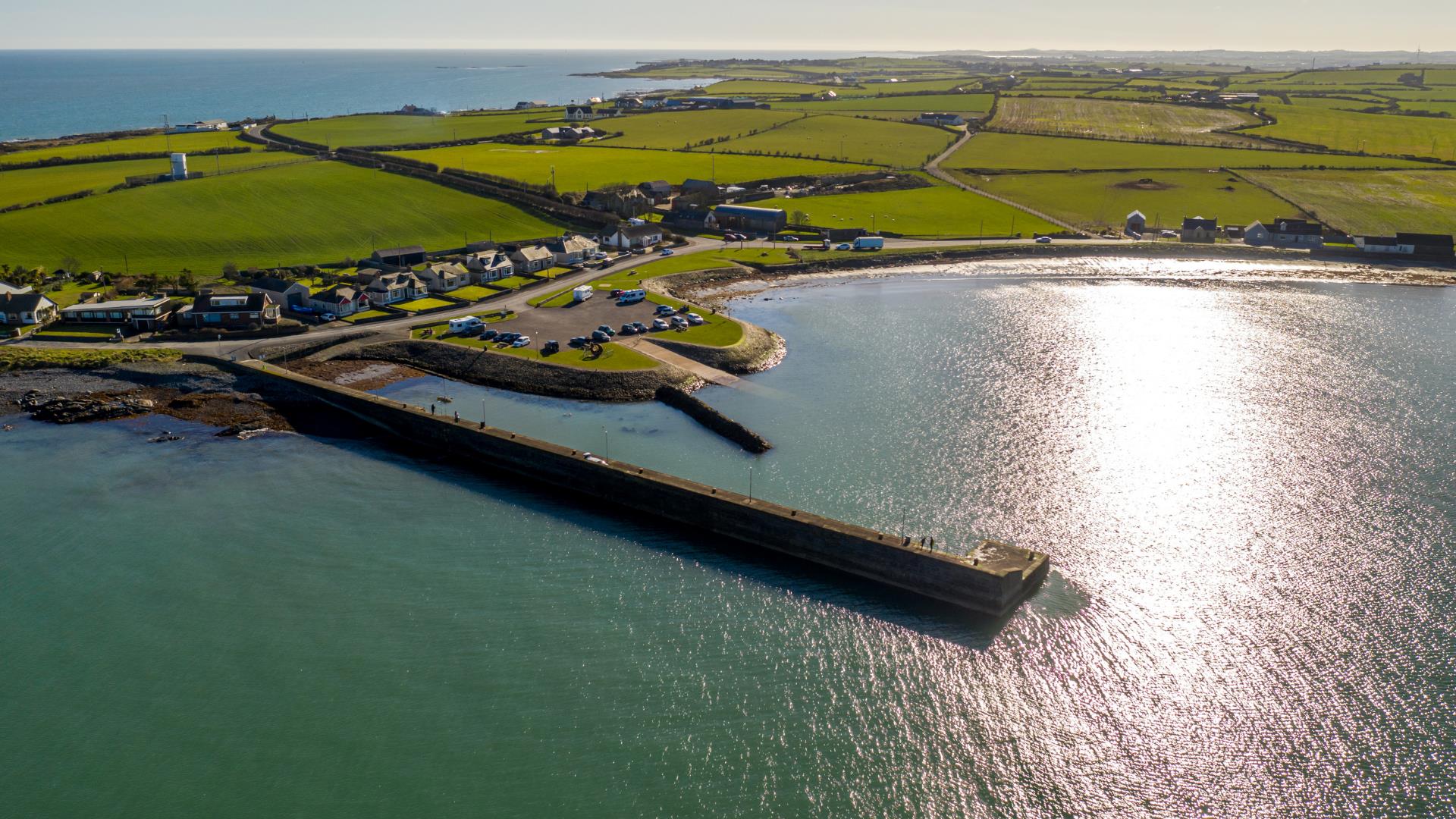
Drone image of Burr Point the most easterly point in Ireland

Book Tickets Online

About

Burr Point is the most easterly point on the mainland of Northern Ireland and on the island of Ireland.  It is located at longitude 5.43⁰ west, two kilometres south of Ballyhalbert and is marked by a sculpture by artist Ned Jackson Smyth. 

Just offshore is the intriguingly named Burial Island.  Local stories say the name comes from a Danish burial reputed to have taken place on the island.  The name might also derive from the Irish for cormorant, na broighill, or from the pronunciation of “Burr Isle”.  The island is a nesting site for terns. 

Nearby is the small and picturesque Ballyhalbert harbour. A disused coastguard tower sits on the hill above Burr Point.  

Burr Point Sculpture Artist: Ned Jackson Smyth.

**NOTE: Please park in the car park at the Harbour and explore on foot – the road to the point is strictly residents’ cars only with no turning point or parking** 


Book Tickets

Guide Prices

Ticket TypeTicket Tariff
TicketFree

Free

Add Burr Point to your Itinerary

Close window

Call direct on:

Tel+44 (0) 28 9182 6846

Map & Directions

Opening Times

* Anytime

What's Nearby

  1. Discover how Echlinville Distillery captures the flavour, colour and mouthfeel of their…

    3.19 miles away
  2. Traditionally believed to have been built by Roland Savage of Ballygalget in 1622,…

    3.37 miles away
  3. A long sandy beach which offers enjoyment for all.

    3.91 miles away
  4. Within it are the ruins of a medieval church which is believed to be the Church of…

    5.17 miles away
  5. Grey Abbey, a Cistercian Abbey church and its living quarters were founded in 1193 by…

    5.64 miles away
  6. Owned by the National Trust, it is a picturesque 18th century fishing village with scenic…

    7.1 miles away
  7. These ruined churches are situated one and a half miles north east of Portaferry on the…

    7.35 miles away
  8. The Lookout is a wildlife interpretative centre, showcasing the wildlife around the…

    7.67 miles away
  9. Mount Stewart is a stunning estate in the beautiful scenic area of Strangford Lough. The…

    7.76 miles away
  10. Nendrum is thought to have been set up by St Machaoi in the 5th Century and also has…

    8.36 miles away
  11. Sketrick Castle is located on Sketrick Island which is reached by a causeway on the west…

    8.36 miles away
  12. This ruined Tower House commands a position at the north end of Mahee Island in…

    8.4 miles away
  13. Millisle Beach Park is an area of 150 metres of golden sand and a relatively safe bathing…

    8.61 miles away
  14. Enjoy a diver's view of marine life from around the world without getting wet. An…

    8.69 miles away
  15. Portaferry Castle is a 16th Century tower-house, built by the Savage family. It is…

    8.69 miles away
  16. Situated on the hill south east of the town below the stump of Portaferry Windmill, a lay…

    8.72 miles away

Virtual Tour

Map & Directions

Road Directions

Directions from Town: Head southeast on Shore Rd/A2 toward Harbour Rd/A2 Continue to follow A2 Go through 1 roundabout Destination will be on the right.

Back to Top

Tourism Northern Ireland

Don't Miss